CONSERVATION CORNER
A weekly blog for all things conservation
 By: Heather McKean; former Penn State Extension educator
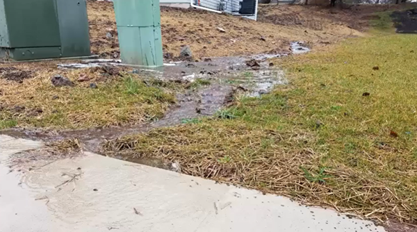
Have you ever discussed stormwater with your neighbor or wondered how to be a better stormwater neighbor? Neighbor disputes over stormwater are very common. Water does not follow property boundaries and there are often instances where water flows from one property onto another and causes damage. It is important to realize that activities on your own property can adversely affect your neighbor's property.
0 Comments
 By: Jennifer R Fetter; Penn State Extension
Having a stream in your yard can be a beautiful addition to your property. It can also be a source of frustration and confusion when things aren't going well. Winter weather and heavy rains this spring my have taken a toll on your backyard stream this year. Or maybe your stream has been slowly eroding for many years. The stream might be getting deeper and deeper. The banks might be caving in, taking your valuable property for a ride downstream. Maybe your foot bridge or fence is about to fall in the stream too. By: Jennifer R Fetter; Penn State Extension Floods are a nuisance. Whether in the streets, parking lots, or your own front yard – they are no fun. Have you ever wondered why your community floods more now than it used to? Beyond being a nuisance, floods have a significant impact in our communities. Floods cause loss of life as well as damage to buildings and other structures. In 2017 alone, Pennsylvanians suffered nearly $7 million worth of property damage and two people lost their lives as a result of flooding.1 What exactly happens during a rain storm that would lead to a flood? It starts with understanding what options rain water has when it hits the ground. In a forest, up to fifteen inches of rain per hour can be absorbed into the soils – becoming groundwater that fills our aquifers and also provides water for trees and other plants to grow. In our developed communities, most of that rain water becomes runoff instead. There are very few places left for water to soak into the ground, so it rolls downhill off of our rooftops, over streets and sidewalks, until it reaches a low point like a stream or river.   By: Susan Boser; Penn State Extension
In Pennsylvania, we get an average of 41 inches of precipitation each year. When it rains or the snow melts, where does this water go? In more natural areas, water is quickly able to infiltrate into the ground. A forested area allows for about 18 inches per hour of infiltration, where an average lawn allows for about 2 inches per hour. Impervious surfaces like pavement and rooftops, offer no infiltration at all. All of the water that doesn't infiltrate flows over the ground, over roofs and through gutters on buildings, into storm drains, and into the nearest waterway –our lakes, rivers, and streams. This is stormwater. 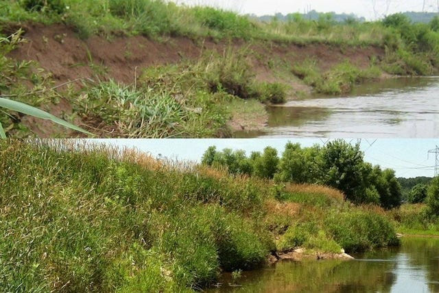 By: Sarah K. Xenophon, Kristen Koch, and Jennifer R Fetter; Penn State Extension
One of the many visual indicators you might use to assess the health of a stream is the amount of stream bank vegetation and other cover. You might find yourself walking along a stream or river, either on your property or when visiting a park or your local woods, and wish you had an easy way to understand the health of that stream. One indicator of stream health is the condition of the stream bank cover. When we talk about stream bank cover, or simply bank cover, we are talking about how much of the soil immediately adjacent to the water is covered by growing vegetation, stable debris, or bedrock material. This helps determine the health of a stream because it can tell us a lot about the relative stability of that stream. A stable stream maintains the same shape and flow pattern over time. A healthy, stable stream typically has more bank cover than an unhealthy stream. Bank cover helps reduce erosion by reducing the amount of soil exposed to passing water as it rushes into and down the stream. The stability of a stream is vital for any organisms that live in and around the stream and for protecting your property and nearby infrastructure (driveways, sewer lines, bridges, and more).  By: Joe Quatrini, Technical Team Leader, BCCD
Last week you read about watersheds and hopefully that got you thinking about how our actions locally impact streams and other waterbodies nearby and even regionally. Today, we’ll narrow our focus a bit to discuss stream order. Simply put, stream order categorizes streams by their size. There’s a little more to it than that, however, its relatively uncomplicated. There’s a basic numbering system: First Order, Second Order, Third Order, and so on, that describes a stream and its position relative to other streams in a watershed. A first order stream is a ‘headwater’ stream or a stream that originates from a spring, a wetland, or a pond, etc. You may have a wet spot in a field on your property and as that spot drains downhill it starts to concentrate, picks up speed, and creates a channel with a defined bed and banks. This would be a first order stream. Sometimes what might complicate this is if someone digs a ditch across their property and after some time, it appears to be a stream and may be categorized as such. This is where some landowners may encounter issues with state or federal agencies if they try to alter or maintain that ‘ditch’ once stream characteristics start to develop. If you’ve been following this column over the last couple years, you’ve read over and over that usually the best option when dealing with water is to let it spread out and not to concentrate it. This adds another dimension to that argument where your initial solution to a problem has created a new problem for you now.  By: Joe Quatrini, Technical Team Leader, BCCD
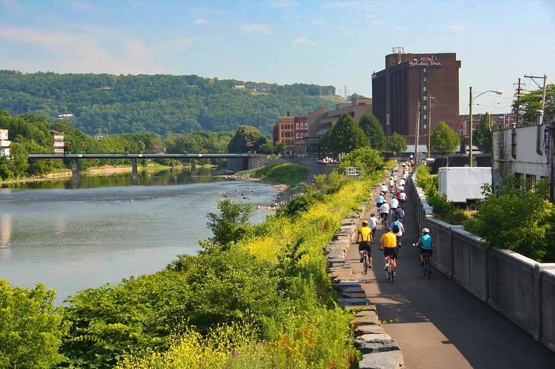
What is a watershed? For some reading this article, a definition or explanation may be easy to come by either due to where you live, your profession, or what your hobbies may be. For others, maybe it’s a word you hear on the nightly news or on social media around discussions led by the Environmental Protection Agency (EPA) and regulations associated with the Chesapeake Bay. Or maybe this is the first time you’ve heard it. By: Ad Crable, Staff Writer, Chesapeake Bay Journal The Susquehanna River has the most flood prone basin east of the Mississippi. And Binghamton, NY, located entirely in a floodplain at the confluence of the Susquehanna and Chenango rivers and downhill of steep, flash-flooding watersheds, might be its most pummeled victim. But now, after the twin punches of an all-time record flood in 2006 followed by an even more devastating 500-year flood only five years later, officials have decided to quit fighting its rivers and instead rebuild to roll with the punches.
By: Joe Quatrini, Technical Team Leader, BCCD Recently, the Bradford County Commissioners made a huge commitment to watershed rehabilitation. Using money from the Act 13 Unconventional Gas Well Fund, the Commissioners have dedicated $200,000 per year toward the restoration of streams to reduce erosion, prevent property loss, protect infrastructure, and improve flood resilience. Building off past successes of the County Stream Initiative program, the commissioners are entrusting BCCD with the administration of these new funds. The funds will be utilized in three critical stream areas: stream stabilization, emergency stream response, and to further the Bradford County stream pilot program. Currently, the Commissioners have designated $110,000 to stream stabilization, $75,000 to emergency stream response, and $15,000 to the stream pilot program. Hopefully, this funding will last for years to come and significant natural resource restoration can be accomplished.
 By: Kevin Brown, Agricultural Resource Specialist
Ok, let’s get down to the brass taxes. What is a rain tax, where is it happening, and what can I do to help the situation without going to that extreme? Who wants to be taxed for rain falling on their property? “We don’t have control over that” is what they say, but we DO have control over what happens to it from there. Can you imagine Towanda (or insert your community here) before it was Towanda? Especially because it is built on a side hill. One thousand years ago a 2-inch rainfall event happened, and all that rain went into the ground. The river level was unaffected. The rainfall gradually moved through the soil layers and the excess was released into the river days or weeks or even months later. The result, no flooding. Picture it during the next 2-inch rainfall that we get. Rain hits your home, it hits the streets, it hits the schools and businesses. In some places there are no places whatsoever for it to infiltrate into the ground. It goes from your downspout to the curb, dumped into the street, adds to the water already running down the street, hits the storm drain and goes DIRECTLY to the river. The result, billions of gallons of water now going down the river that never made it there before. And it is going there like NOW. Add that to water coming from Sayre and Waverly and Athens and Chemung and Binghamton and Owego, etc. The town fathers didn’t think about this when they set up some of the systems, but as more and more communities grow, they are thinking about it now. Now we have a huge problem. We have concentrated all that water and sent it downstream (along with it- pollution, erosion, sediment, nutrients, etc.). Again, do we care enough to try and fix it one house at a time? Or do we institute a (wait for it…) Stormwater Fee (RAIN TAX)? NNNOOOOOOOO!! |
AuthorsVarious staff at the Bradford County Conservation District Archives
May 2024
Categories
All
|
|
Bradford County Conservation District
Stoll Natural Resource Center 200 Lake Road, Suite E | Towanda PA 18848 Phone: (570)-485-3144 |
Find Us on Social Media!
|